|
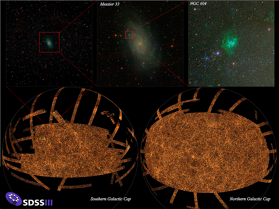
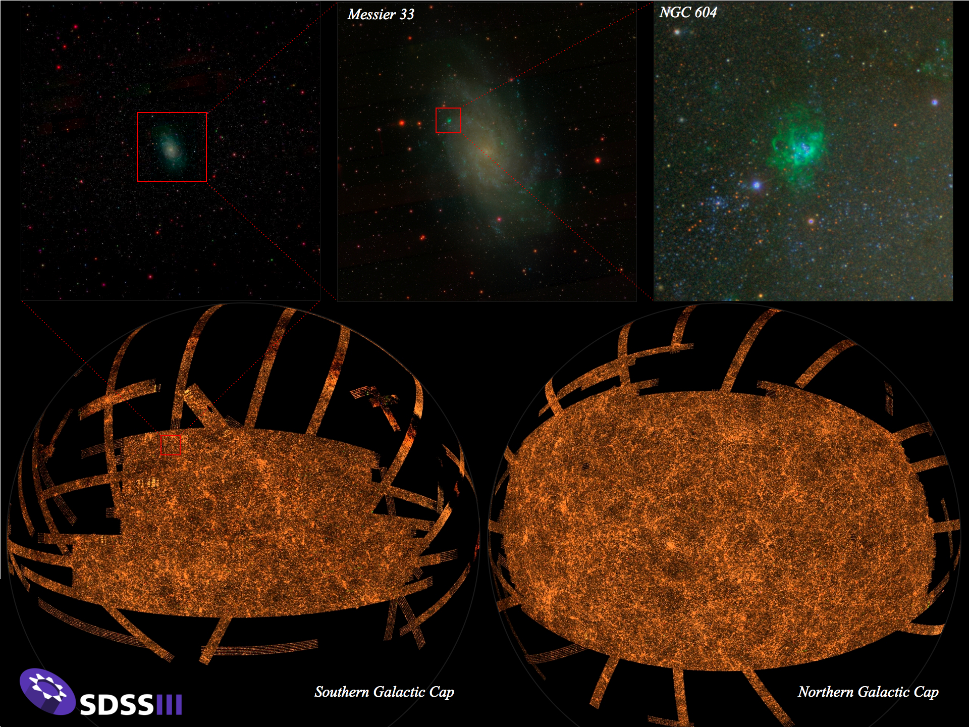
The bottom panel shows the sky coverage of the final SDSS imaging survey, including data from SDSS I, II, and III. SDSS imaging covered slightly more than 1/3 of the sky, concentrated in the northern and southern Galactic caps (above and below the plane of the galaxy). In this image, stripes are radiating out from these caps; these stripes are areas imaged by the SEGUE survey, extending toward the plane of the Milky Way. Each orange dot in this map is a galaxy. The sequence of zooms in the upper panels zeroes in on the star-forming nebula NGC 604 in the nearby (2.5 million light years) galaxy Messier 33. In all, the SDSS imaging map shown here contains more than a trillion pixels, each one imaged in five colors.
This image has appeared in several print publications; it is available in
publication-quality resolution.
|